From the above it can be seen that town of Beaufort West provides an ideal location for economic rejuvenation and social upliftment in the area.
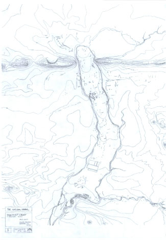
The first panel, The Natural Order, is basically a contour map. This shows the gap in the Nuweveld Mountains to the north. It is from this point that the river system flows to the town. Then, to the south east the contours show the path along which the Hans River flows.
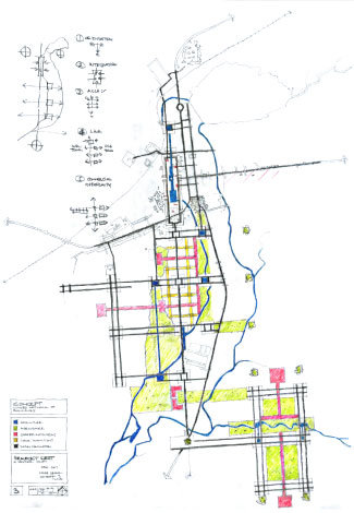
The next panel shows the built fabric. Here the rail line can be seen in the top left quadrant of the panel as it skirts the town to the north west. The rail line crosses the N1 motorway at the north end of the town. The N1 motorway runs north / south. To the east of the N1 is the historic old town. On the left, to the west of the N1, lies the newer, low income housing.
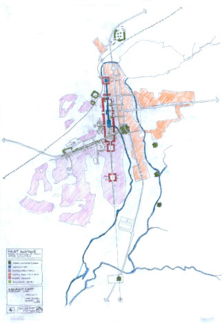
The third panel shows the concept. Spatially the landform forms a triangle by descibed by the two peaks either side of the pass through the Nuweveld mountains to the north and thirdly by a very prominent rocky koppie to the south (as seen extreme south, middle, on the contours of panel 1). The Gamka River then bisects this triangle, almost centrally, in a north-south direction. Where the Gamka River runs between the historic fabric of the old town and the new low income housing it is proposed that the river is to be formalized. A huge urban enclosed space then be formed around this formalized part of the river. The space being something along the lines of the magnitude of the Maidan at Isfahan. This space forming a huge, and vital, public place capable of accommodating many different activities. The enclosing buildings defining the space predominantly two or three stories high with commercial activity happening at ground level. The Gamka River runs through this, carefully designed so as to afford fountains, river side seating and a variety of other urban elements. Thereby enlivening the space, providing ambiance, sound, and a small microclimatic oasis as air passing over water sprays is cooled. Further, this space would be orientated and located within the broader landscape. Visually referencing to the triangle of the three mountain koppies descibed above.
Furthermore it is envisaged that this will create a vibrant space to unite and integrate communities, previously segregated along racial lines. So the Gamka River, previously a spatially dividing element would now rather become a spatial, and symbolic,element of unity.
From this main space, orientated along its north-south axis, the town can later extend in a southwards direction. Thereby even further integrating the marginalized low cost housing into the main activities of the town. At the same time providing much needed quality public space to the low cost housing area. Ideally future expansion of the town should also utilize the opportunities provided by the Gamka River in its place making. It is envisaged that possibly some sort of commercial fish farming be then introduced. Possibly in connection with a major institution of higher learning. Thereby creating greater regional connections and economic benefits. Should this then later further develop, and more space be needed, the concept can be extended in an easterly direction along the Hans River.
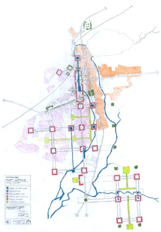
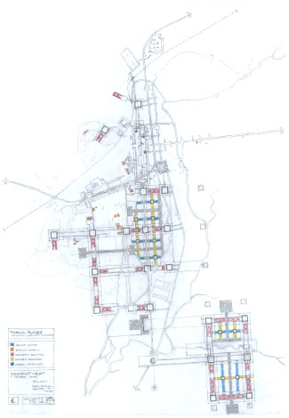
The fourth panel, First Actions, is the most important panel. This panel shows, in a single diagram, the idea and critical first actions needed to achieve it.
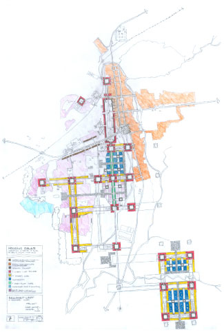
The fifth panel shows how the concept be expanded to reach its development potential. However, for this proposal to be successful, this full development need never be reached.
The last two panels then give an indication as to how the vibrant elements of public places and how housing would fit into the scheme. |
 Fig. 1: Beaufort West locality.